Best road atlases, folded maps and compasses for when the phone fails (2027 editions)
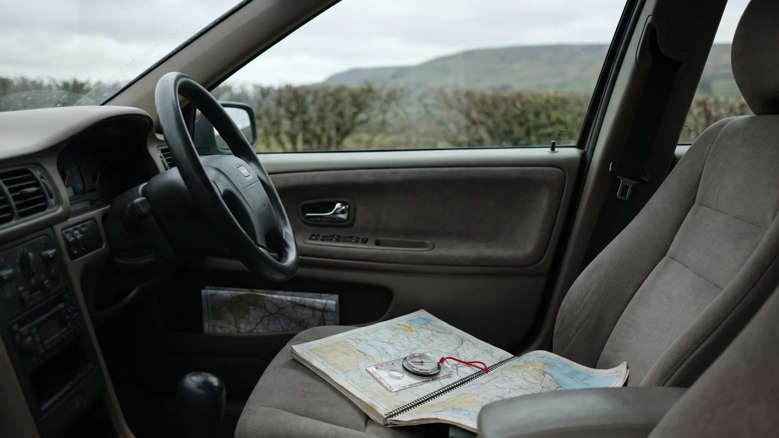
Sat-nav is better than paper almost every day of the year. The exception is the day it stops: a long power cut takes mobile masts down with it once their batteries run out, a phone dies with no way to charge, or you are somewhere with no signal and the map tiles never loaded. A current paper atlas and a compass matched to Ordnance Survey scales weigh little and need no power. This page compares the 2027 Collins and Philip's atlases, Collins folded maps and three Silva compasses using the publishers' and maker's own figures; we have not driven or walked with any of them ourselves.
By Tom Calder · Updated 21 October 2026 · 10 products, all price-tracked
Our picks by type
 Photo: Amazon
Philip's Easy A4 spiral
A detailed everyday atlas with a larger mapping scale than most A4 rivals.
as of 21 Oct 2026, 10:37 BST · Details
Product prices and availability are accurate as of the date/time indicated and are subject to change. Any price and availability information displayed on Amazon.co.uk at the time of purchase will apply to the purchase of this product. Photo: Amazon
Collins Britain folded map
A slim overview of the whole country to keep as a backup in the glove box.
as of 21 Oct 2026, 10:37 BST · Details
Product prices and availability are accurate as of the date/time indicated and are subject to change. Any price and availability information displayed on Amazon.co.uk at the time of purchase will apply to the purchase of this product. Photo: Amazon
Silva Ranger
A dependable all-round compass for use with paper maps and OS-style scales.
as of 21 Oct 2026, 10:37 BST · Details
Product prices and availability are accurate as of the date/time indicated and are subject to change. Any price and availability information displayed on Amazon.co.uk at the time of purchase will apply to the purchase of this product.All 10 compared
| Map or compass | Type | Edition / scale | Size | Good to know | Price |
|---|---|---|---|---|---|
Road atlas, lie-flat spiral · 2027; 1:150,000 (Philip's) · A4 · Over 350 pages A detailed everyday atlas with a larger mapping scale than most A4 rivals. | Road atlas, lie-flat spiral | 2027; 1:150,000 (Philip's) | A4 | Over 350 pages | £14.19 at Amazon as of 21 Oct 2026, 10:37 BST · DetailsProduct prices and availability are accurate as of the date/time indicated and are subject to change. Any price and availability information displayed on Amazon.co.uk at the time of purchase will apply to the purchase of this product.In stockCheck price → |
Our verdictOur verdictResearched Philip's uses a 1:150,000 scale, about 2.4 miles to the inch, across more than 350 pages in A4. The spiral binding lies flat on a passenger's lap or a table. It is the most detailed A4 option in this group. Best for A detailed everyday atlas with a larger mapping scale than most A4 rivals. Good
Worth knowing
Who shouldn't buy it: You only want a thin overview map. | |||||
 Road atlas, spiral-bound · 2027; 3.2 miles to 1 inch (Collins) · A4, 210x297mm · Route planning maps and distance chart A standard A4 paper road atlas to keep in the car as a backup to sat-nav. | Road atlas, spiral-bound | 2027; 3.2 miles to 1 inch (Collins) | A4, 210x297mm | Route planning maps and distance chart | £11.90 at Amazon as of 21 Oct 2026, 10:37 BST · DetailsProduct prices and availability are accurate as of the date/time indicated and are subject to change. Any price and availability information displayed on Amazon.co.uk at the time of purchase will apply to the purchase of this product.In stockCheck price → |
Our verdictOur verdictResearched Collins draws England, Wales and southern Scotland at about 3.2 miles to the inch, with a coarser scale for the north of Scotland. Paper needs no signal or charge, so it still works when mobile masts and sat-nav apps do not. The route-planning pages and distance chart help you pick a route before you set off. Best for A standard A4 paper road atlas to keep in the car as a backup to sat-nav. Good
Worth knowing
Who shouldn't buy it: You mainly need street-level detail for towns rather than a road overview. | |||||
Baseplate compass · Scales 1:25,000 and 1:50,000 · 10.7x5.4x1.1 cm · Magnifier, declination scale, lanyard A dependable all-round compass for use with paper maps and OS-style scales. | Baseplate compass | Scales 1:25,000 and 1:50,000 | 10.7x5.4x1.1 cm | Magnifier, declination scale, lanyard | £23.99 at Amazon as of 21 Oct 2026, 10:37 BST · DetailsProduct prices and availability are accurate as of the date/time indicated and are subject to change. Any price and availability information displayed on Amazon.co.uk at the time of purchase will apply to the purchase of this product.In stockCheck price → |
Our verdictOur verdictResearched Silva lists the Ranger as a baseplate compass with 1° accuracy, a magnifying lens and a declination scale inside the capsule. The 1:25,000 and 1:50,000 scales match Ordnance Survey maps. It works with no battery, so it pairs well with a paper atlas or map. Best for A dependable all-round compass for use with paper maps and OS-style scales. Good
Worth knowing
Who shouldn't buy it: You have never used a compass and will not practise. | |||||
 Road atlas, spiral-bound · 2027; 3.2 miles to 1 inch (Collins) · A3, 295x385mm · 22 urban approach maps, 64 town plans A large-format atlas that is easy to read at a glance for a passenger or planner. | Road atlas, spiral-bound | 2027; 3.2 miles to 1 inch (Collins) | A3, 295x385mm | 22 urban approach maps, 64 town plans | £12.17 at Amazon as of 21 Oct 2026, 10:37 BST · DetailsProduct prices and availability are accurate as of the date/time indicated and are subject to change. Any price and availability information displayed on Amazon.co.uk at the time of purchase will apply to the purchase of this product.In stockCheck price → |
Our verdictOur verdictResearched The A3 version of the Collins atlas uses the same 3.2 miles to 1 inch mapping for most of Britain, printed large enough to read without squinting. Collins adds 22 larger-scale urban approach maps and 64 town-centre plans. It is a home or car-boot reference more than a pocket item. Best for A large-format atlas that is easy to read at a glance for a passenger or planner. Good
Worth knowing
Who shouldn't buy it: You want something compact to carry in a grab bag. | |||||
 Baseplate compass · Expert level (Silva) · 6x12.5x1 cm · Added functions for GPS use Experienced navigators who want a full-size compass with extra features. | Baseplate compass | Expert level (Silva) | 6x12.5x1 cm | Added functions for GPS use | £29.99 at Amazon as of 21 Oct 2026, 10:37 BST · DetailsProduct prices and availability are accurate as of the date/time indicated and are subject to change. Any price and availability information displayed on Amazon.co.uk at the time of purchase will apply to the purchase of this product.In stockCheck price → |
Our verdictOur verdictResearched Silva rates the Expedition 4 as an expert-level, full-size baseplate compass, used by rescue workers and keen outdoor users, with added functionality for GPS. Accuracy is 1° and it is waterproof. It is more compass than most households need, but a good choice if you will learn it properly. Best for Experienced navigators who want a full-size compass with extra features. Good
Worth knowing
Who shouldn't buy it: You need a simple first compass. | |||||
 Road atlas, paperback · 2027; 1:150,000 (Philip's) · A4 · Over 350 pages The same Philip's mapping as the spiral edition in a flexible paperback that slides into a bag. | Road atlas, paperback | 2027; 1:150,000 (Philip's) | A4 | Over 350 pages | £13.65 at Amazon as of 21 Oct 2026, 10:37 BST · DetailsProduct prices and availability are accurate as of the date/time indicated and are subject to change. Any price and availability information displayed on Amazon.co.uk at the time of purchase will apply to the purchase of this product.In stockCheck price → |
Our verdictOur verdictResearched This edition has the same over-350-page, 1:150,000 mapping as the spiral version, in a paperback binding. The softer cover is easier to pack, though it will not stay open on its own. Choose it if storage matters more than lie-flat use. Best for The same Philip's mapping as the spiral edition in a flexible paperback that slides into a bag. Good
Worth knowing
Who shouldn't buy it: You want the atlas to stay open on a table or lap. | |||||
 Road atlas, lie-flat spiral · 2027; 1:150,000 (Philip's) · A3 · Large maps, extra detail Readers who want the biggest, clearest print for planning at home. | Road atlas, lie-flat spiral | 2027; 1:150,000 (Philip's) | A3 | Large maps, extra detail | £14.19 at Amazon as of 21 Oct 2026, 10:37 BST · DetailsProduct prices and availability are accurate as of the date/time indicated and are subject to change. Any price and availability information displayed on Amazon.co.uk at the time of purchase will apply to the purchase of this product.In stockCheck price → |
Our verdictOur verdictResearched Philip's prints its 1:150,000 mapping at A3, so place names and roads are large and easy to read. The lie-flat spiral suits use on a table. It is a reference for the house or boot rather than something to carry. Best for Readers who want the biggest, clearest print for planning at home. Good
Worth knowing
Who shouldn't buy it: You need something to carry on foot or in a small bag. | |||||
Folded road map, double-sided · 2027; 8.7 miles to 1 inch (Collins) · Folded 137x238mm · Counties and unitary authorities shown A slim overview of the whole country to keep as a backup in the glove box. | Folded road map, double-sided | 2027; 8.7 miles to 1 inch (Collins) | Folded 137x238mm | Counties and unitary authorities shown | £7.51 at Amazon as of 21 Oct 2026, 10:37 BST · DetailsProduct prices and availability are accurate as of the date/time indicated and are subject to change. Any price and availability information displayed on Amazon.co.uk at the time of purchase will apply to the purchase of this product.In stockCheck price → |
Our verdictOur verdictResearched One double-sided sheet covers Great Britain at 8.7 miles to the inch, with northern England, Scotland and the Isle of Man on one side and southern England and Wales on the other. It is a planning overview for long-distance routes, not a replacement for a detailed atlas. Its slim fold makes it easy to keep in a glove box. Best for A slim overview of the whole country to keep as a backup in the glove box. Good
Worth knowing
Who shouldn't buy it: You need detail for local or rural routes. | |||||
 Baseplate compass · Scales 1:25,000 and 1:50,000 · 5.1x7.6x1 cm · Entry level; detachable lanyard A small, low-cost first compass for learning map bearings. | Baseplate compass | Scales 1:25,000 and 1:50,000 | 5.1x7.6x1 cm | Entry level; detachable lanyard | £15.99 at Amazon as of 21 Oct 2026, 10:37 BST · DetailsProduct prices and availability are accurate as of the date/time indicated and are subject to change. Any price and availability information displayed on Amazon.co.uk at the time of purchase will apply to the purchase of this product.In stockCheck price → |
Our verdictOur verdictResearched Silva describes the Classic as an entry-level compass for schools and leisure navigators. It has a rotatable housing, 1:25,000 and 1:50,000 scales and a detachable lanyard. It is small enough for a grab bag or glove box. Best for A small, low-cost first compass for learning map bearings. Good
Worth knowing
Who shouldn't buy it: You want advanced features such as a declination scale. | |||||
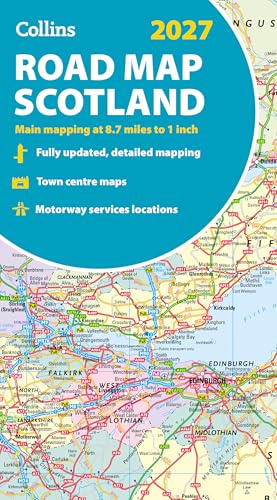 Folded road map, single sheet · 2027; 8.7 miles to 1 inch (Collins) · Folded 127x238mm · Covers Scotland and part of N England Households in Scotland or planning Scottish journeys who want a paper overview. | Folded road map, single sheet | 2027; 8.7 miles to 1 inch (Collins) | Folded 127x238mm | Covers Scotland and part of N England | £7.51 at Amazon as of 21 Oct 2026, 10:37 BST · DetailsProduct prices and availability are accurate as of the date/time indicated and are subject to change. Any price and availability information displayed on Amazon.co.uk at the time of purchase will apply to the purchase of this product.In stockCheck price → |
Our verdictOur verdictResearched Collins shows the whole of Scotland and part of northern England on one side at 8.7 miles to the inch, with administrative areas in colour. It suits route planning rather than fine navigation. Paper is useful in areas where mobile signal is patchy. Best for Households in Scotland or planning Scottish journeys who want a paper overview. Good
Worth knowing
Who shouldn't buy it: You travel mostly outside Scotland. | |||||
ⓘ As an Amazon Associate, PreparedBritain earns from qualifying purchases. We may earn a commission when you buy, or a fee when you request a quote, through our links — it never affects what we recommend. Amazon prices come from Amazon's own product data and show the date and time they were retrieved. Prices at other retailers are checked by us, less often. Prices and stock can change at any time, so always check the retailer's price before you buy.
Before you buy
Start with why paper is on this page at all.
A phone's map needs three things: charge, a signal and, for most apps, map tiles already downloaded. In a long power cut the first two fail together, because mobile masts run on mains with limited battery backup (see our power-cut guides). A digital landline stops too unless it has battery backup. A road atlas needs none of that. It will not route you around a closure, but it will show you the next junction, the alternative A-road and the towns in between, which is what matters when you are rerouting a journey or driving to a relative.
Scale decides how much you can see.
Collins draws England, Wales and southern Scotland at 3.2 miles to the inch, with northern Scotland coarser: 4.2 miles to the inch in the A4 Essential atlas and 5 miles to the inch in the A3 Big atlas. Philip's uses 1:150,000, about 2.4 miles to the inch, and its A4 edition runs to more than 350 pages, so it shows more minor roads at the cost of a thicker book. The Collins folded maps sit at 8.7 miles to the inch: fine for choosing a route across the country, too coarse for lanes.
Then size and binding.
A4 is the practical car size: it fits a door pocket or under a seat. A3 editions from both publishers print the same mapping larger, which helps anyone who finds small print hard, but they belong on a kitchen table or in the boot. Spiral binding lies flat on a lap; Philip's paperback has identical mapping but will not stay open on its own and packs more easily. The folded Collins maps are the lightest option by far and the only ones that make sense in a grab bag, where every gram counts.
Check the edition year before you pay.
Road atlases carry the following year's date, so the 2027 editions listed here are the current ones on sale now. Older stock is often sold alongside at similar prices, and on a marketplace the ISBN is the only reliable way to tell them apart. The extras differ too: the Collins A3 atlas carries 22 urban approach maps and 64 town-centre plans, the A4 Essential has route-planning pages and a distance chart, and the Collins Road Map of Britain shows county and unitary authority boundaries, useful when a warning or a road closure is announced by local authority.
A compass belongs with a walking map, not a road atlas.
Silva lists 1:25,000 and 1:50,000 scales on the Classic and Ranger to match Ordnance Survey Explorer and Landranger sheets, and rates all three models here as waterproof and accurate to one degree. The Classic is small and entry level; the Ranger has a magnifier and a declination scale; the Expedition 4 is a full-size expert model with extra GPS-related functions, though Silva lists no map scales for it. Keep any compass away from phones, magnets and the car's speakers, which can disturb the needle, and practise taking a bearing on a local walk first.
We verify every product's specifications against at least two independent sources, re-check its UK price and stock on a schedule where we can track it automatically, and cross-check safety-relevant claims against official guidance. Every review is labelled Researched or Used and reviewed by us: where we've bought a product, or been sent it free, and used it ourselves, its review says which; where we haven't, our verdict is a considered spec-and-evidence comparison, not a hands-on test — and commissions never change a ranking either way. Read our full methodology →
Related kit comparisons
Guides that go with this
The free number to save today, what to have ready, food safety, staying warm safely, and the compensation you …
A calm, sourced look at the 'national blackout' scenario: why it's a low-likelihood risk the grid is engineere…
A simple, practical household emergency plan — the official GOV.UK Prepare approach: contacts, meeting points,…
The UK's old copper phone network is being switched off by January 2027. What the digital switchover means, wh…
The UK’s version of a bug-out bag is a grab bag for leaving home quickly. What GOV.UK and the Environment Agen…
Common questions
Why would I need a paper map when my phone has sat-nav?
Because the phone's map depends on charge, a signal and downloaded tiles, and a long power cut removes the first two at once. Mobile masts have limited battery backup, so after the first hours of a wide outage the signal thins out, and a phone cannot be recharged from a dead socket. Paper also covers no-signal areas on ordinary days. An atlas is the backup you hope never to open, in the same way as the torch in the glove box.
Which is better, Collins or Philip's?
They differ mainly in scale. Philip's draws Britain at 1:150,000, about 2.4 miles to the inch, so it shows more minor roads but runs to more than 350 pages. Collins uses 3.2 miles to the inch for England, Wales and southern Scotland and a coarser scale for the north, and its A4 Essential atlas adds route-planning pages and a distance chart. If you drive rural roads, Philip's detail helps; for main-road journeys, Collins is enough.
Do I need the 2027 edition or is last year's fine?
An atlas a few years old still works, since the road network changes slowly. What a new edition adds is recent bypasses, junction changes and updated town plans. If you are buying new, pay for the current year, because older stock is often sold alongside at much the same price; check the ISBN rather than the cover. If you already own one from the last three or four years, there is no need to replace it for a backup role.
Should the atlas be A4 or A3?
A4 for the car. It fits a door pocket or under a seat and is light enough to pass to a passenger. A3 editions print the same mapping larger, which suits anyone who finds small print difficult or who plans routes at a table, but they are awkward in a moving car and too big for a bag. If you want one for each job, keep an A4 in the car and the A3 at home.
Can I navigate by road with a compass?
A compass tells you direction, not where the roads go, so on its own it is of limited use in a car. It earns its place paired with an Ordnance Survey map on foot: the Silva Classic and Ranger carry 1:25,000 and 1:50,000 scales to match OS Explorer and Landranger sheets. If you only ever drive, spend the money on a better atlas instead. If you walk, cycle or might have to leave a car and continue on foot, a compass and the right OS sheet are worth carrying.
What else should go with the map in the car?
A torch or head torch to read it by, since interior lights drain a battery, a pencil to mark a route, and a note of the addresses you might need to reach without a phone: relatives, your GP, the nearest hospital. Keep them together in the door pocket with the atlas. Our car emergency kit and winter driving kit pages cover the rest, and the household emergency plan guide explains where to write the addresses down so everyone can find them.